Lot #: 84778
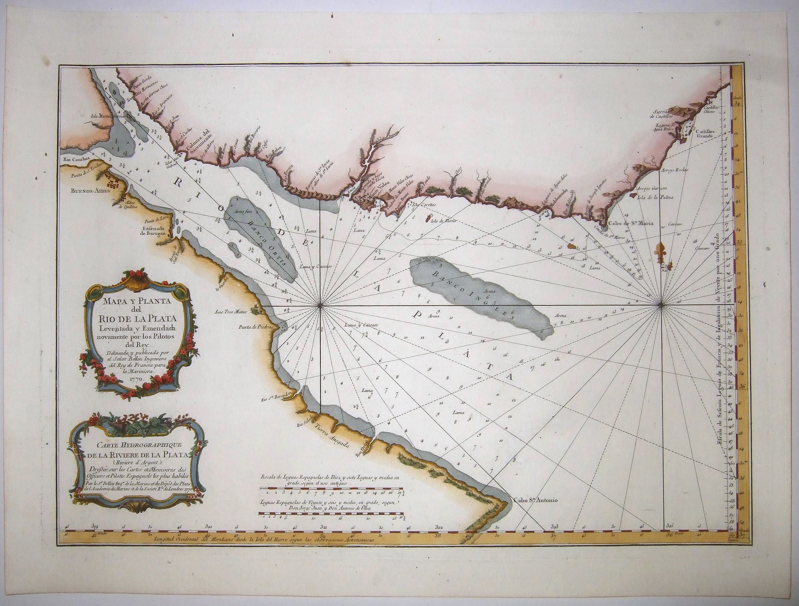
ARGENTINE/URUGUAY,La Plata River, Carte Hydrographique de la Riviere de la Plata [Riviere d'Argent] . . . |
||||||||||||||||||||
|
||||||||||||||||||||
|
|
||||||||||||||||||||
|
|
Views: 355
|
|||||||||||||||||||
Description
A French naval chart of the Rio de la Plata - famous for the wealth it produced for the Spanish Empire [Translation from French title: 'River of Silver']. This chart details the mouth of the Rio de la Plata, extending from Cabo San Antonio in Argentina to Castillos in Uruguay. Numerous rivers are identified along the coastline, although only a few cities are shown, including Buenos Aires, Ensenada de Baragan, and Montevideo.
The bay is filled with soundings, anchorages, and shoals. Adorned with two decorative rococo-style title cartouches in Spanish and French. This is a 'Hydrographie Francaise' issue, probably the first state of this map, still without the engraved stamp and the price of dix huit sols at bottom right. A crisp impression on watermarked paper, by Jacques Nicolas Bellin 1770.
Jacques-Nicolas Bellin (1703-1772) was among the most important mapmakers of the eighteenth century. In 1721, at age 18, he was appointed hydrographer (chief cartographer) to the French Navy. In August 1741, he became the first Ingénieur de la Marine of the Depot des cartes et plans de la Marine (the French Hydrographic Office) and was named Official Hydrographer of the French King.
During his term as Official Hydrographer, the Depot was the single most active centre for the production of sea charts and maps, including a large folio format sea-chart of France, the 'Neptune Francois'. He also produced a number of sea-atlases of the world, e.g., the Atlas Maritime and the 'Hydrographie Francaise'. These gained fame, distinction, and respect all over Europe and were republished throughout the 18th and even in the succeeding century.
Bellin also came out with smaller format maps such as the 1764 'Petit Atlas Maritime', containing 580 finely detailed charts. He also contributed many of the maps for Bellin and contributed a number of maps to the 15-volume 'Histoire Generale des Voyages' of Antoine François Prévost or simply known l'Abbe Prevost.
Bellin set a very high standard of workmanship and accuracy, thus gaining for France a leading role in European cartography and geography. Many of his maps were copied by other mapmakers of Europe.
FAQ - Guarantee - Shipping
Rarepapersales has been discontinued.
You can now bid on old maps on the Liveauctioneers platform.These auctions are hosted by NewWorldCartographic from Chicago.
Paulus Swaen keeps selling their maps on its own platform www.swaen.com