Lot #: 82867
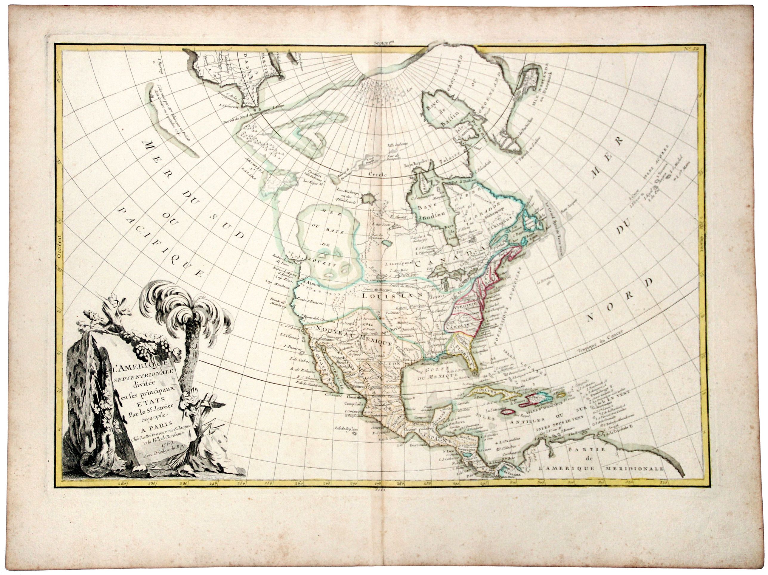
L' AMERIQUE SEPTENTRIONALE divisee en les principaux ETATS.[Great western sea, First State] |
||||||||||||||||||||
|
||||||||||||||||||||
|
|
||||||||||||||||||||
|
This item has been sold.
Selling price: $300 Sold in 2019 Join News Letter to get informed when a similar item comes available. |
Views: 194
|
|||||||||||||||||||
Description
First state for this very important map. Engraved by Lattré. This map is most notable for it's depiction of Mer de L'Quest or Sea of the West, near modern-day Seattle.
A great sea, easily the size of the Mediterranean, to flow from the then-known Strait of Juan de Fuca. Showing an opening to the ocean from this great sea at roughly in North California or Oregon and Quivira somewhere in Idaho.
Fattening Alaska and appropriately leaving blank the unknown parts of Northern America. Listing Indian nations, towns such as Sante Fe and an almost north/south Rio du Nord.
New Albion is on the southwest shore of this great inland sea, which inundates virtually all of present-day British Columbia and Alberta. There is not any sign of a recognisable Alaska. The British colonies are confined east of the Appalachian Mountains with French Louisiana stretching to the Pacific Northwest.
Florida is controlled by Spain. Ft. Cenis and Santa Fe are visible within the Spanish territories in the southwest, labeled Nouveau Mexique here. The large, decorative title cartouche, incorporating a palm tree and grape vines, was engraved by Berthault.
FAQ - Guarantee - Shipping
Rarepapersales has been discontinued.
You can now bid on old maps on the Liveauctioneers platform.These auctions are hosted by NewWorldCartographic from Chicago.
Paulus Swaen keeps selling their maps on its own platform www.swaen.com