Lot #: 97977
Listing ID: #29601 has been removed from your wishlist.
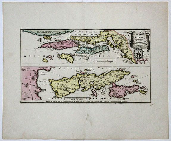
Le Gouvernement de RAGUSE, estant une Partie de DALMATIE, 1730 ca |
||||||||||||||||||||
|
||||||||||||||||||||
|
|
||||||||||||||||||||
|
|
Views: 171
|
|||||||||||||||||||
Description
A copperplate map with original color.
Two maps on one sheet show the Republic of Ragusa on the Dalmatian coast around Dubrovnik, embracing the area from Kotor to the island Korcula, Hvar and Island Cres and Losinj, with a part of the Istrian coast below. The text next to Dubrovnik describes the city being destroyed in the earthquake of 1667, but being rebuilt later.
The upper image is partly based on the map by Vincenzo Coronelli from ca 1695 showing the Republic of Dubrovnik (Ragusa) that existed from 1358 to 1808.
The uncommon lower map showing the island Cres is dedicated to Giovanni Antonio Petris, a lecturer of philosophy at the Bologna Universiti. Petris da Cherso (or Petric in Croatian) came from an old noble family of Cres. Because of the text in Italian language we can assume the lower map was based on an older Italian draft.
Reference: Atlas Major bd. 44, tvl. 87
Reference: Atlas Major bd. 44, tvl. 87
FAQ - Guarantee - Shipping
Rarepapersales has been discontinued.
You can now bid on old maps on the Liveauctioneers platform.These auctions are hosted by NewWorldCartographic from Chicago.
Paulus Swaen keeps selling their maps on its own platform www.swaen.com