Lot #: 82628
Listing ID: #36491 has been removed from your wishlist.
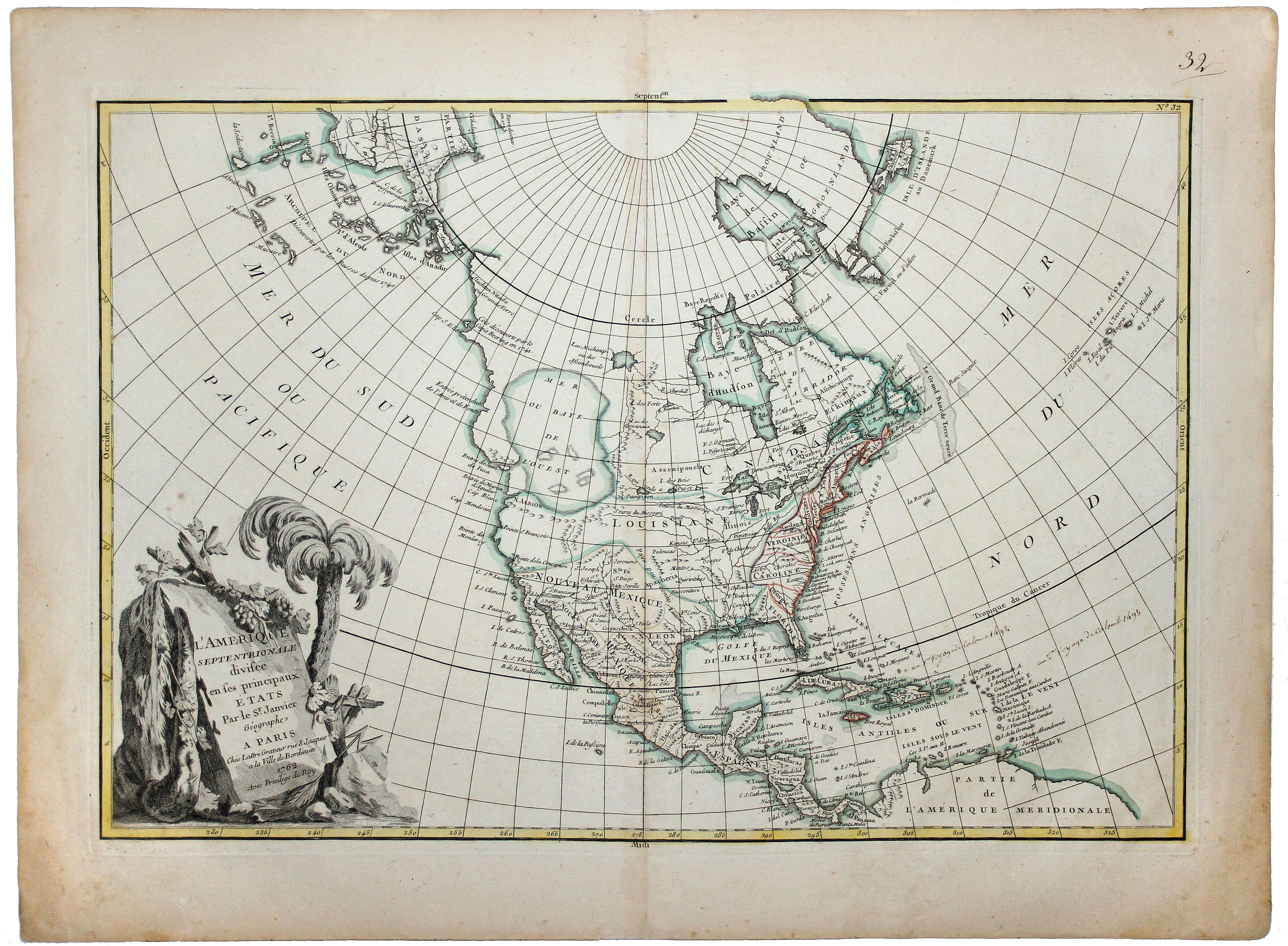
L'AMERIQUE SEPTENTRIONALE divisee en ses principaux ETATS, 1782.[Great Western Sea] |
||||||||||||||||||||
|
||||||||||||||||||||
|
|
||||||||||||||||||||
|
This item has been sold.
Selling price: $250 Sold in 2019 Join News Letter to get informed when a similar item comes available. |
Views: 228
|
|||||||||||||||||||
Description
A fine example of Janvier's map of North America to illustrate the sea of the west. "Mer ou Baye de l'Ouest", prior to the incorporation of information from Cook's Voyage. Also, the hypothetical Alaskan archipelago theorised from the reports of Behring and Tchirakow is replaced by more conservative, although equally inaccurate, mapping of the NW Coast to the Arctic Circle.
The US is named (pre the 1783 Treaty). Numerous Indian names & early French forts shown.
Reference: Wheat 192; Wagner 559.
The US is named (pre the 1783 Treaty). Numerous Indian names & early French forts shown.
Reference: Wheat 192; Wagner 559.
FAQ - Guarantee - Shipping
Rarepapersales has been discontinued.
You can now bid on old maps on the Liveauctioneers platform.These auctions are hosted by NewWorldCartographic from Chicago.
Paulus Swaen keeps selling their maps on its own platform www.swaen.com