Lot #: 82815
Listing ID: #37082 has been removed from your wishlist.
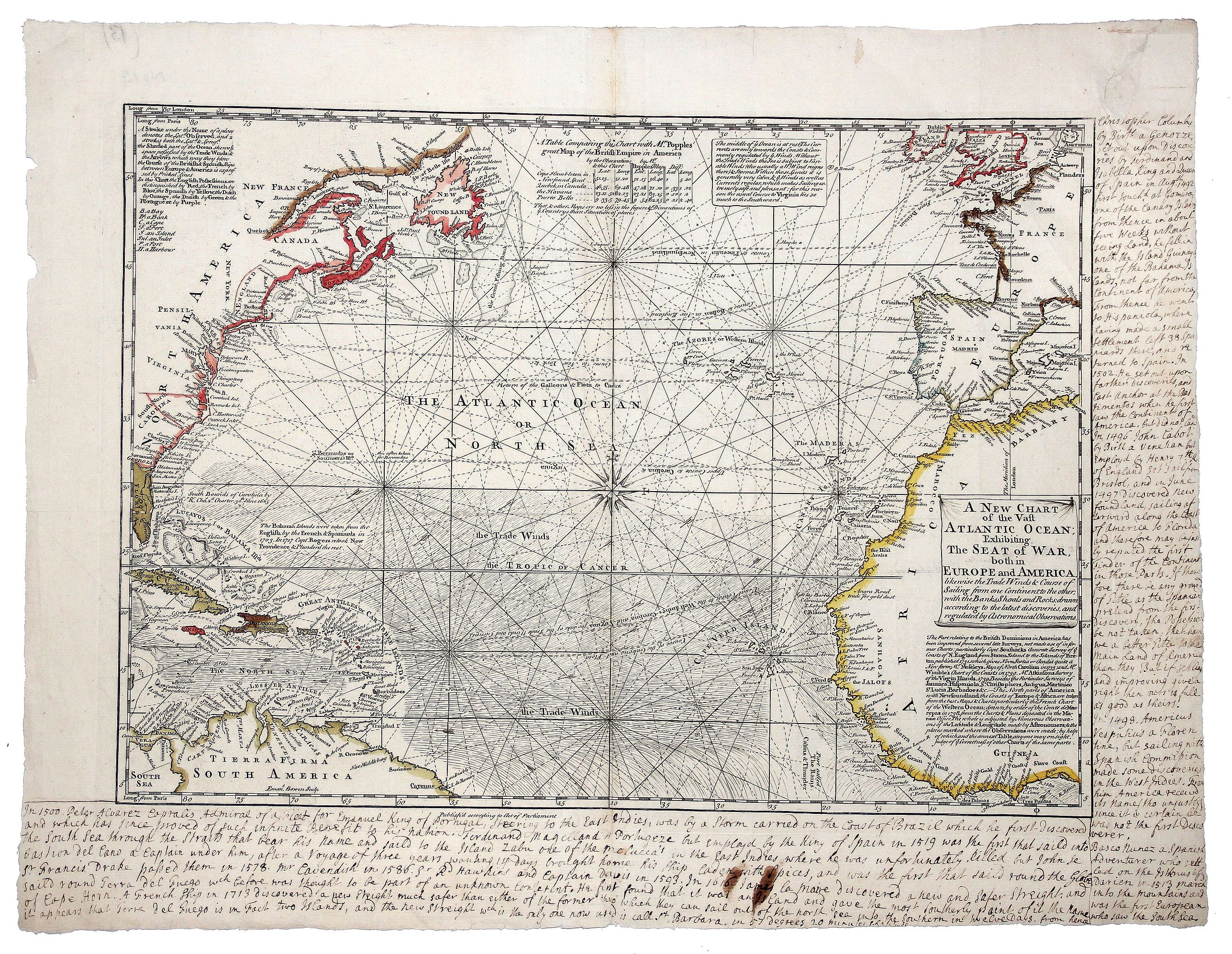
A NEW CHART of the Vast ATLANTIC OCEAN, Exhibiting The SEAT of WAR, both in EUROPE and AMERICA.[Popple] |
||||||||||||||||||||
|
||||||||||||||||||||
|
|
||||||||||||||||||||
|
|
Views: 188
|
|||||||||||||||||||
Description
A scarce map of the Atlantic with Sailing Routes To New York & Boston! A fine example of Bowen's fascinating broadside map of the Atlantic, which includes a table comparing the chart with Henry Popple's great map of the British Empire in America, first issued in 1740.
It includes rich details concerning the various sailing routes of Spain and England to their various territorial possessions in the New World, along with notes regarding the Bahamas, Bermuda and the Carolinas and extensive annotations and notes regarding the British Colonies in North America and the currents of the Atlantic.
It includes rich details concerning the various sailing routes of Spain and England to their various territorial possessions in the New World, along with notes regarding the Bahamas, Bermuda and the Carolinas and extensive annotations and notes regarding the British Colonies in North America and the currents of the Atlantic.
FAQ - Guarantee - Shipping
Rarepapersales has been discontinued.
You can now bid on old maps on the Liveauctioneers platform.These auctions are hosted by NewWorldCartographic from Chicago.
Paulus Swaen keeps selling their maps on its own platform www.swaen.com