Lot #: 82847
Listing ID: #37142 has been added to your wishlist.
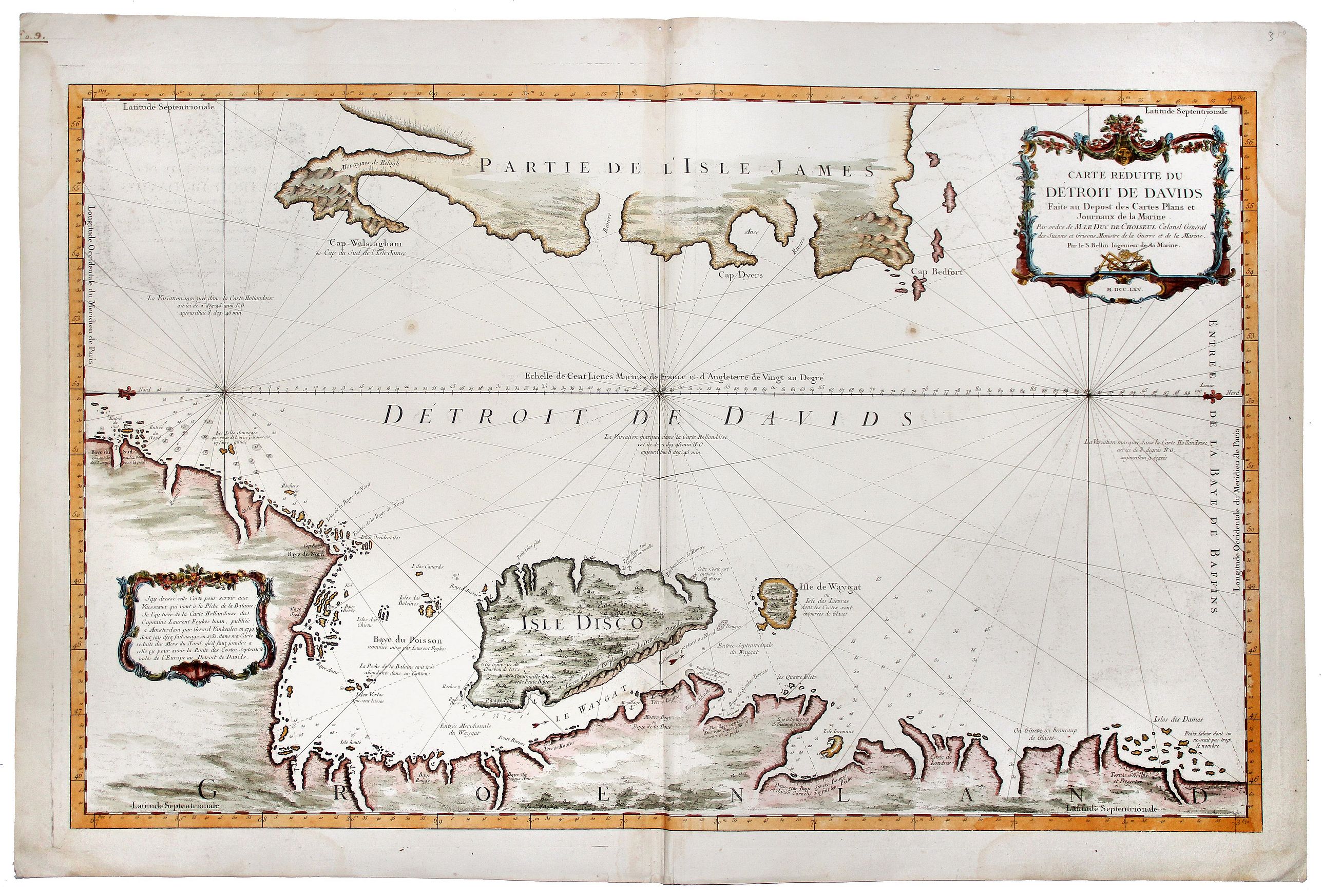
Carte Reduite du DETROIT DE DAVIDS. Faite an Depost des Cartes Plans et Journaux de la Marine, . . . MDCCLXV. |
||||||||||||||||||||
|
||||||||||||||||||||
|
|
||||||||||||||||||||
|
|
Views: 157
|
|||||||||||||||||||
Description
A beautiful, large chart of the French sea of the Davis Strait, published by Jacques Nicolas Bellin in Paris.
The note at the bottom left indicates that the map was constructed for use in the Whaling industry and is based upon a Dutch chart by Laurent Feykes, which was later published in Amsterdam by Gerard van Keulen from 1719.
Oriented with west at the top, the coastline of Greenland at the bottom of the map is well detailed with place names, soundings, water currents, and anchorages. In contrast, the eastern coastline of L'Isle James (Baffin Island) is only partially outlined.
FAQ - Guarantee - Shipping
Rarepapersales has been discontinued.
You can now bid on old maps on the Liveauctioneers platform.These auctions are hosted by NewWorldCartographic from Chicago.
Paulus Swaen keeps selling their maps on its own platform www.swaen.com