Lot #: 82994
Listing ID: #37597 has been added to your wishlist.
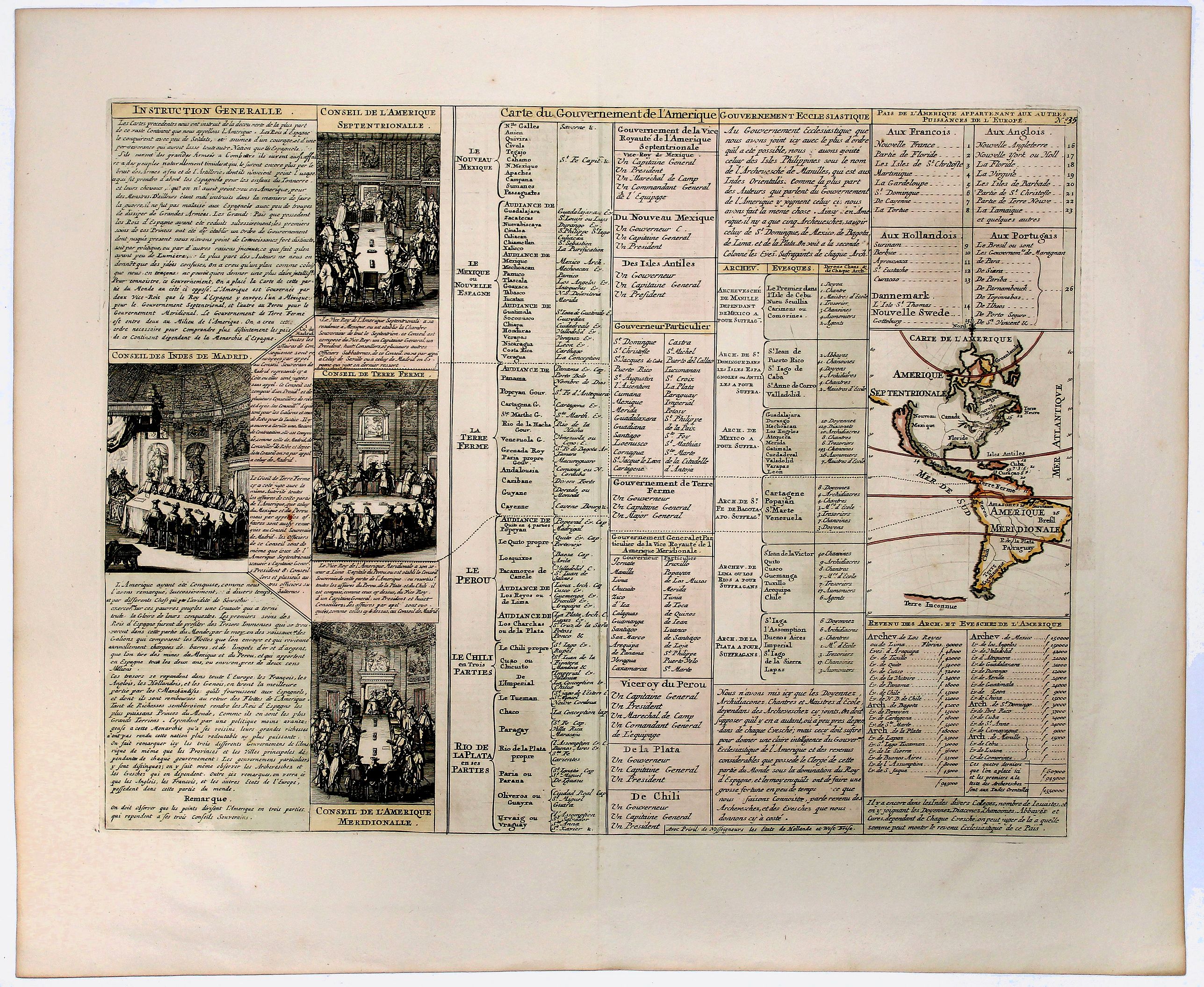
Carte du Gouvernement de l' Amerique [California Island]. |
||||||||||||||||||||
|
||||||||||||||||||||
|
|
||||||||||||||||||||
|
This item has been sold.
Selling price: $120 Sold in 2019 Join News Letter to get informed when a similar item comes available. |
Views: 249
|
|||||||||||||||||||
Description
An interesting chart depicting the European possessions in North and South America. A wonderful example of Chatelain’s elegant maps. Included in the 1721 edition of the 'Atlas Historique', published by Chatelain in Amsterdam, this large chart is the thirty-eighth map in volume one.
One of the most fascinating plates in the atlas, this fine engraving outlines the division of European possessions across North and South America. The sheet is comprised of a large central table which lists the principle governmental infrastructures, ecclesiastical organisations, and geographical delineations.
A key identifying the principal locations of the European possessions is also provided, along with a lengthy historical note. A small inset map of North and South America shows California as an island and New Mexico extending across most of western North America up into Canada.
The plate is also adorned with a set of finely drawn images depicting the various offices of government. By combining a wealth of information and geographical observation, with delicate engraving and an uncomplicated composition, this elegant plate is a superb example from the golden age of French mapmaking.
More about "Chatelain Atlas." [+]
FAQ - Guarantee - Shipping
Rarepapersales has been discontinued.
You can now bid on old maps on the Liveauctioneers platform.These auctions are hosted by NewWorldCartographic from Chicago.
Paulus Swaen keeps selling their maps on its own platform www.swaen.com