Lot #: 83067
Listing ID: #37667 has been added to your wishlist.
Listing ID: #30778 has been added to your wishlist.
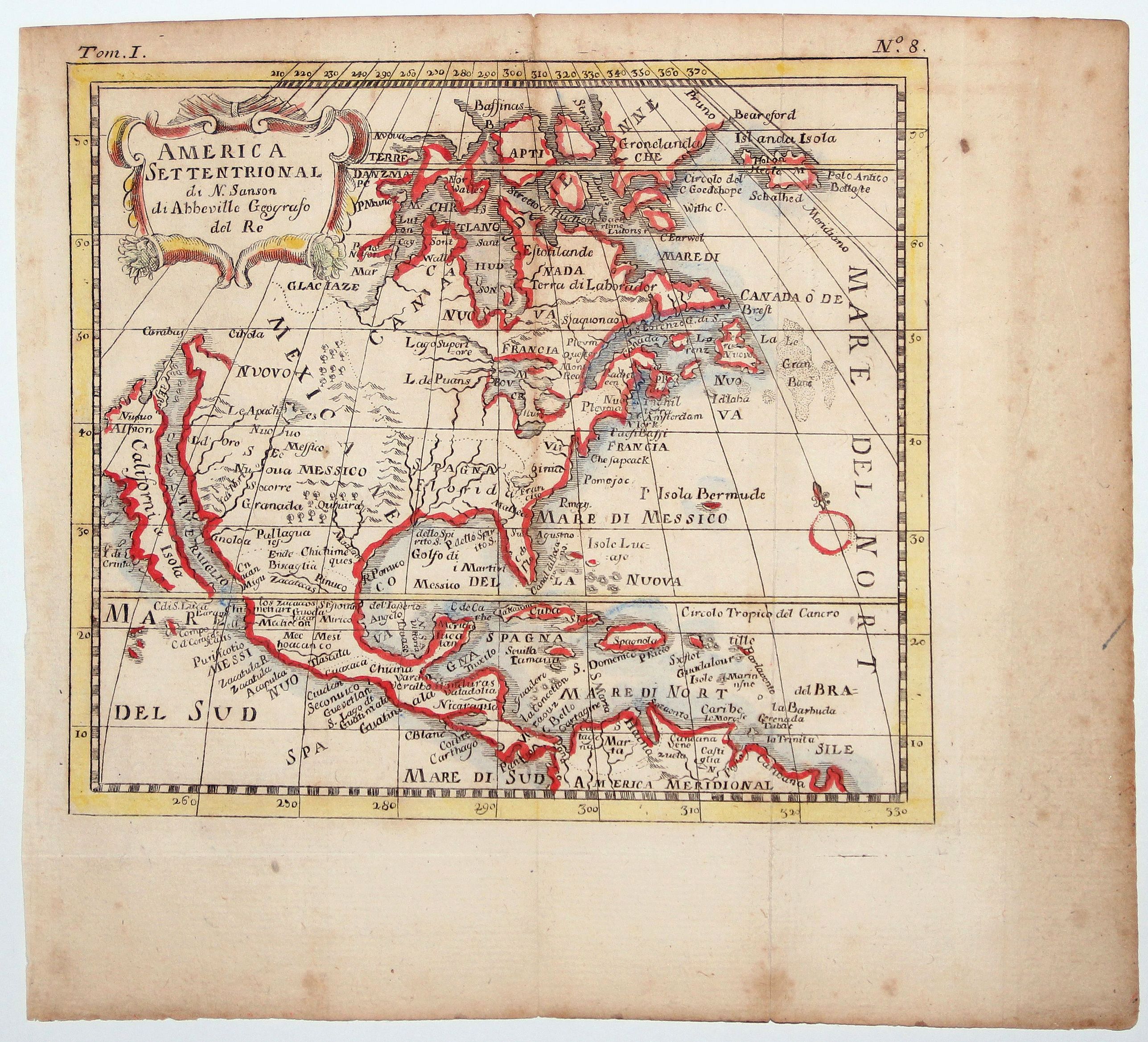
AMERICA SETTENTRIONAL di N. Sanson (California Island) |
||||||||||||||||||||
|
||||||||||||||||||||
|
|
||||||||||||||||||||
|
This item has been sold.
Selling price: $190 Sold in 2020 Join News Letter to get informed when a similar item comes available. |
Views: 240
|
|||||||||||||||||||
Description
Very rare old outline color example of Nicolas Sanson's map of North America.
California is depicted as an island; McLaughlin notes: "California with indented northern coast, with nothing to west and Agubela de Cato to north." Among the place names are C. de Mendocino, Pta. de los Reyes, Pta. de Monte Rey, Pta. de Francisco Draco (south of Pta de Monte Rey), Canal de S. Barbara, I. de S. Catalina, P. de S. Diego, etc. In the southwest, there is a large lake near Taosii, with R. de Norte flowing southwest from it to the Mar Rosso.
The map features an early open-ended Great Lakes (one of the earliest appearances of the 5 Great Lakes) and a mis-located pre-La Salle/Jolliet/Hennepin projection of the Mississippi River, pushed well west of its true location and quite speculative in its course. Nice detail in the Spanish Southwest along the Rio Grande, locating Taos and Santa Fe in the North and identifying Cibola.
A number of early Indian names, including the Apaches and Zuni appear. A Lago de Oro is shown off the Gulf of California. Quivera appears in modern day Texas, along with Granada. The East Coast of North America includes many early place names, including N. Amsterdam, Chesapeac, Powhata, Gotheburg (an early Swedish Settlement), Bristou London, Plimouth, Nassau, Elsinburg, R. Iourdain, etc.
In the top left corner is a decorative cartouche.
FAQ - Guarantee - Shipping
Rarepapersales has been discontinued.
You can now bid on old maps on the Liveauctioneers platform.These auctions are hosted by NewWorldCartographic from Chicago.
Paulus Swaen keeps selling their maps on its own platform www.swaen.com