Lot #: 83192
Listing ID: #37926 has been removed from your wishlist.
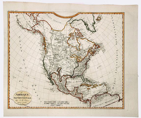
AMERIQUE SEPTENTRIONALE. |
||||||||||||||||||||
|
||||||||||||||||||||
|
|
||||||||||||||||||||
|
This item has been sold.
Selling price: $110 Sold in 2019 Join News Letter to get informed when a similar item comes available. |
Views: 264
|
|||||||||||||||||||
Description
A detailed map of North America, issued shortly before the publication of the official account of Lewis & Clark's expedition to the Pacific Ocean.
The map shows a very primitive knowledge of the western US, with no sign of the mythical rivers which would dominate Western Cartography for the next 25 years. A massive Louisiana Territory is shown, shortly after the Louisiana Purchase.
Some knowledge of the Missouri River is shown, but its course westward toward the Rocky Mountains is not yet known. The treatment of the Rocky Mountains as a single Cordillera pre-dates the style popularised by Humboldt.
FAQ - Guarantee - Shipping
Rarepapersales has been discontinued.
You can now bid on old maps on the Liveauctioneers platform.These auctions are hosted by NewWorldCartographic from Chicago.
Paulus Swaen keeps selling their maps on its own platform www.swaen.com