Lot #: 83578
Listing ID: #38541 has been added to your wishlist.
A MAPP OF EUROPE. |
||||||||||||||||||||
|
||||||||||||||||||||
|
|
||||||||||||||||||||
|
This item has been sold.
Selling price: $300 Sold in 2020 Join News Letter to get informed when a similar item comes available. |
Views: 248
|
|||||||||||||||||||
Description
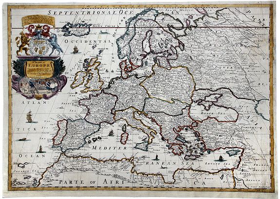
A fine example of Blome's scarce map of Europe, the earliest folio size map of Europe to be engraved and printed in England.
The map demonstrates the naïve engraving style characteristic of 17th Century English engravers, and features an elaborate heraldic cartouche and a dedication to Prince James, Duke of Yorke & Albany, Marquesse Ormonde, Earle of Ross and High Admiral of England. The map includes many sailing ships and sea monsters.
Blome's maps, because of their rarity and importance in the history of English Cartography, are essential items for regional collectors. Blome first began engraving maps for his 'Geographical Description Of The Four Parts Of The World' in 1667. The completed volume was in small folio, and contained 24 maps (plus one duplicated), engraved by Francis Lamb, Thomas Burnford and Wenceslas Hollar.
Blome's principal handicap in the production of the atlas was the lack of a domestic mapmaking environment comparable with that in Europe. Also, to finance his work, he undertook subscribers, in exchange for a promise to add their coat of arms to certain maps.
In later editions, if the renewal fee was not paid, Blome added a different subscribers coat of arms, leading to multiple images on various editions of the same map.
FAQ - Guarantee - Shipping
Rarepapersales has been discontinued.
You can now bid on old maps on the Liveauctioneers platform.These auctions are hosted by NewWorldCartographic from Chicago.
Paulus Swaen keeps selling their maps on its own platform www.swaen.com