Lot #: 80164
Listing ID: #6567 has been removed from your wishlist.
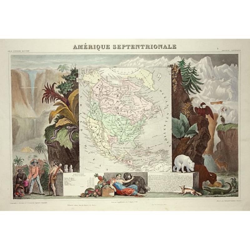
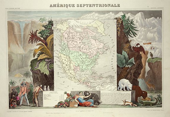
Amerique Septentrionale |
||||||||||||||||||||
|
||||||||||||||||||||
|
|
||||||||||||||||||||
|
This item has been sold.
Selling price: $240 Sold Join News Letter to get informed when a similar item comes available. |
Views: 249
|
|||||||||||||||||||
Description
Lovely map with an INDEPENDENT TEXAS. The United States extending into present day Canada, Russia in control of Alaska and Mexico's northern border according to the Treaty of 1810.
Surrounded by beautifully engraved scenes of North and Central America including local animals, a ship stranded in the polar sea, and a Mayan Temple.
A very popular and decorative 19th century map.
Surrounded by beautifully engraved scenes of North and Central America including local animals, a ship stranded in the polar sea, and a Mayan Temple.
A very popular and decorative 19th century map.
FAQ - Guarantee - Shipping
Rarepapersales has been discontinued.
You can now bid on old maps on the Liveauctioneers platform.These auctions are hosted by NewWorldCartographic from Chicago.
Paulus Swaen keeps selling their maps on its own platform www.swaen.com