Lot #: 80165
Listing ID: #6568 has been added to your wishlist.
Globus Terrestris |
||||||||||||||||||||
|
||||||||||||||||||||
|
|
||||||||||||||||||||
|
|
Views: 206
|
|||||||||||||||||||
Description
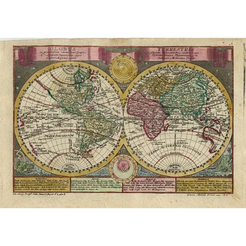
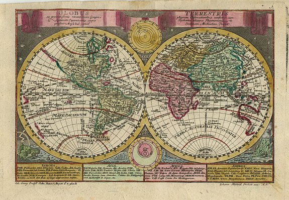
Charming double hemisphere map based on the cartography of Johann Schreiber. The map is surrounded by engravings of the heavens and natural phenomena such as waterspouts, a rainbow, earthquakes, and a volcano.
The map itself shows a typical 18th century geographical view with an incorrect northwest coastline in North America and most of the Pacific incompletely mapped. Nestled between the hemispheres are two depictions of the solar system, one based on Copernicus and the other on Tycho Brahe's model.
The title is contained in a banner across the top with text panels at the bottom naming the major regions of each continent.
FAQ - Guarantee - Shipping
Rarepapersales has been discontinued.
You can now bid on old maps on the Liveauctioneers platform.These auctions are hosted by NewWorldCartographic from Chicago.
Paulus Swaen keeps selling their maps on its own platform www.swaen.com