Browse Listings in Antique Maps > Map Types > Folding maps
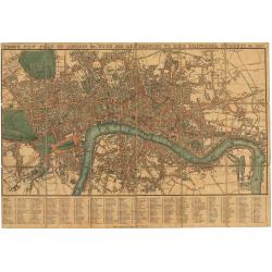
Tegg's New Plan of London, &c. with 360 References to the Principal Streets, &c. 1827.
This is a fine example of an early 19th-century folding map tailored for travelers navigating London, highlighting 260 principal streets. First released by Thomas Tegg of...
Place & Date: London 1823 / 1827
Selling price: $350
Sold in 2024
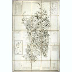
Carta dell isola e regno di Sardegna.
Considered the first map of Sardinia according to modern geodesic methods, it was realized thanks to the work of Alberto Ferrero della Marmora, later assisted by Majo...
Place & Date: Paris and Torino, 1845
Selling price: $500
Sold in 2022
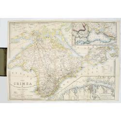
The Crimea by James Wyld Geographer to the Queen & H.R.H. Prince Albert.
The second edition of this folding map of Crimea. In the upper right corner, an inset map of the areas around the Black Sea, "The Town & Harbor of Sevastopol wit...
Place & Date: London, 1854
Selling price: $250
Sold in 2017
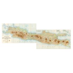
Overzichtskaart van Java en Madoera schaal 1:500.000. Met aanduiding van de politieke indeeling, de organisatie van het bestuur, de bestaande en nog aan te leggen verkeerswegen en van de groote cultuur- en industrieele centra. Samengesteld op last va
If assembled a very large color-printed map (60x 218cm.) of Java and Madoera (Madura Island) on four sheets, each measuring 60 x 54.5 cm, dissected into 12 sections and l...
Place & Date: Atelier Kurkdjian-Soerabaia, 1912
Selling price: $470
Sold in 2023