Lot #: 91751
Listing ID: #17351 has been added to your wishlist.
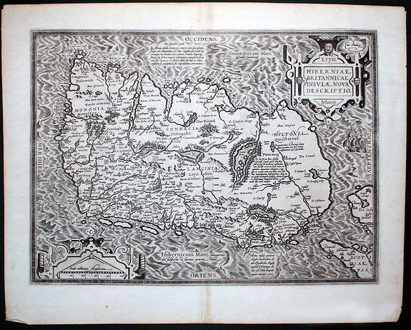
Eryn - Hiberniae, Britannicae Insulae, Nova Descriptio - Irelandt |
||||||||||||||||||||
|
||||||||||||||||||||
|
|
||||||||||||||||||||
|
Selling price: $1300
Sold in 2011 |
Views: 237
|
|||||||||||||||||||
Description
A beautiful map of Ireland from Ortelius' "Theatrum Orbis Terrarum" or Atlas of the whole world. This is one of the earliest maps of Ireland to present it with any significant detail.
It was based on Mercator's famous 1564 wall map of the British Isles. The map is divided into counties and shows towns, rivers, lakes, forests, coastal islands and other details. Richly embellished with a sailing vessel and two decorative cartouches.
French text verso
Reference: Koeman: Ort 22 (13)
It was based on Mercator's famous 1564 wall map of the British Isles. The map is divided into counties and shows towns, rivers, lakes, forests, coastal islands and other details. Richly embellished with a sailing vessel and two decorative cartouches.
French text verso
Reference: Koeman: Ort 22 (13)