Lot #: 32911
Listing ID: #19606 has been added to your wishlist.
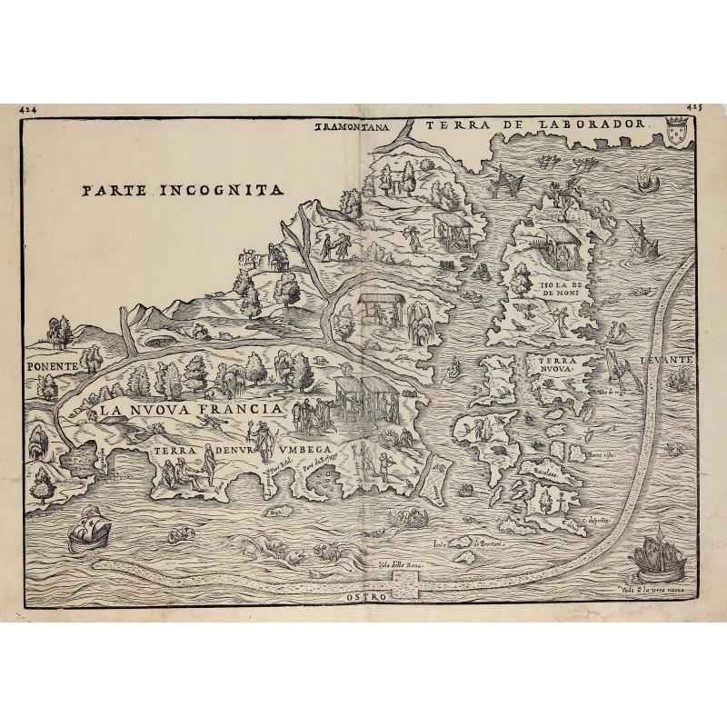
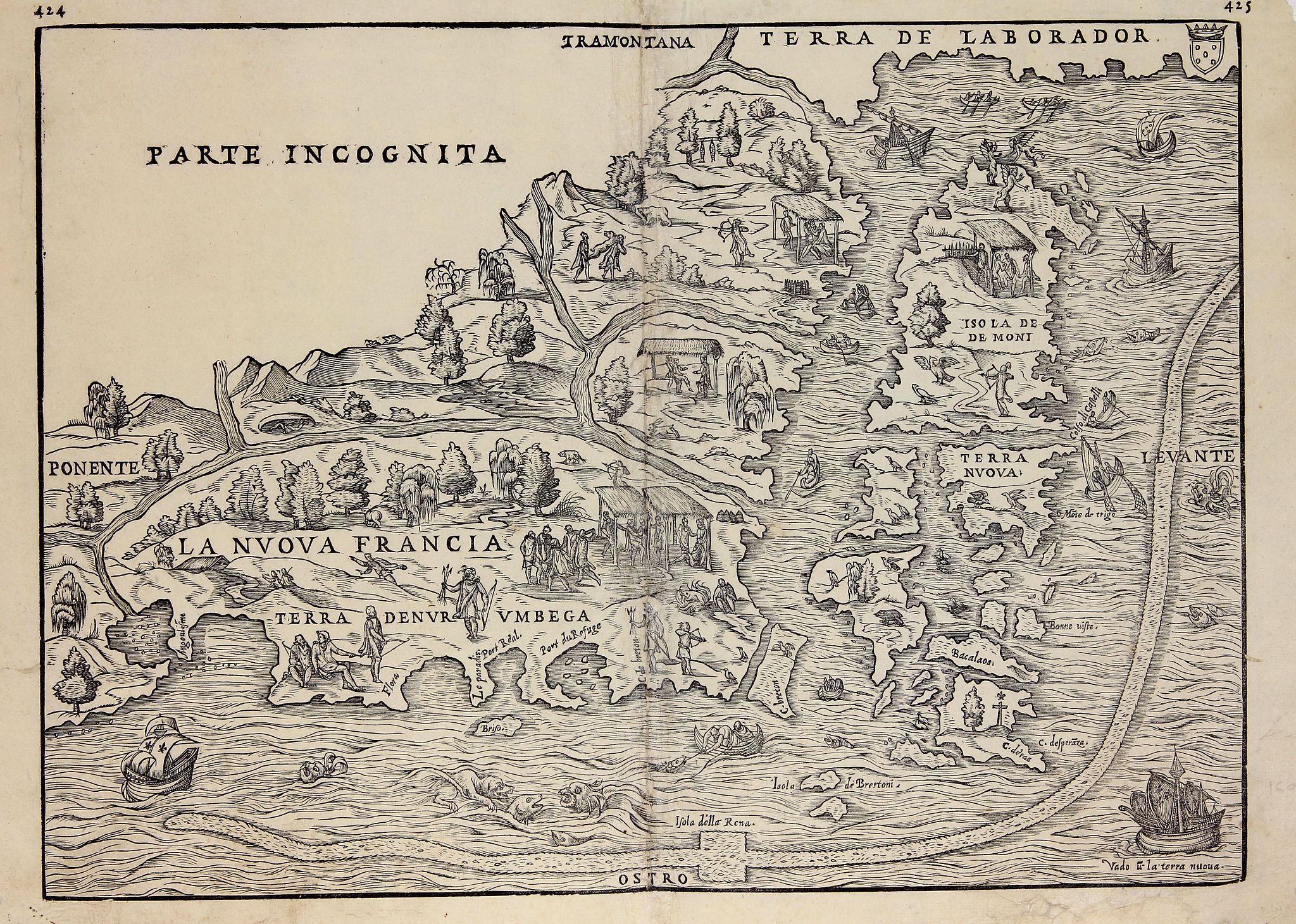
La Nuova Francia. |
||||||||||||||||||||
|
||||||||||||||||||||
|
|
||||||||||||||||||||
|
Selling price: $2800
Sold in 2012 |
Views: 170
|
|||||||||||||||||||
Description
Second state of the woodcut map of the Atlantic coastline from New York to Labrador. Manhattan as the peninsula "Angouleme", named after King Francis I, Duke of Angouleme.
First separate map devoted to New England and the first to name New France. It is also the first to delineate New York Harbor and Manhattan with some degree of accuracy and detail.
From : Ramusio Delle Navigationi Et Viaggi …, Venice, 1565, vol. 3. The second block can be identified by the presence of weeping willow trees, for example along the left hand border.
Published by Ramusio to accompany the first printed report of Verazzano’s voyage of 1524, drawing the area directly from Verazzano’s reports of the promising harbor he discovered. Surprisingly, Verazzano’s reports were ignored by most cartographers of the day and, even though Gastaldi’s map was readily available, New York Harbor would not be sought out again for eighty five years.
Reference: McCorkle, New England in Early Printed Maps, #556.1. Schwartz and Ehrenberg. The Mapping of America. NY: Harry Abrams, 1980. Verner and Stuart-Stubbs. The Northpart of America. Toronto: Academie Press Canada Ltd., 1979.