Lot #: 32914
Listing ID: #19609 has been removed from your wishlist.
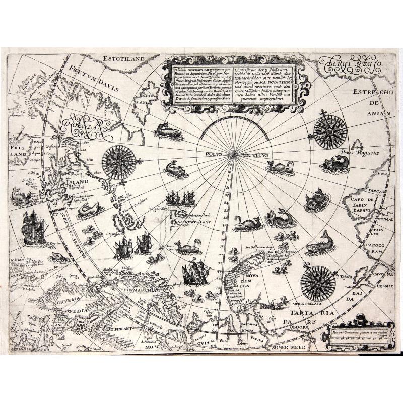
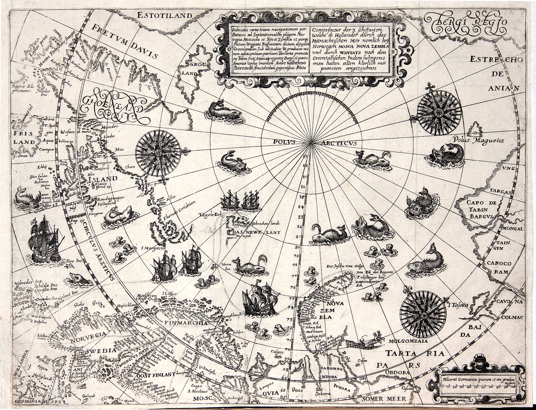
Deliniatio cartae trium navigationum per Batavos. . . |
||||||||||||||||||||
|
||||||||||||||||||||
|
|
||||||||||||||||||||
|
Selling price: $1900
Sold in 2012 |
Views: 235
|
|||||||||||||||||||
Description
A major landmark in Arctic cartography incorporating recent voyages including Barents' third voyage to this region, made in 1596-7. A derivative of Willem Barentsz's map with decorative exuberance, the map contains 34 illustrations of sea monsters, ships and whales and an island named Polus Magnetis.
Theodore de Bry, a German engraver and book dealer, began a compilation of early voyages in 1590 and had published six parts at the time of his death in 1598. His widow, two sons, and another family member continued the work, which comprised a total of fifty-four parts when it was completed in 1630. The publication is in two series, denoted the Grands Voyages and the Petit Voyages. A German edition of the Petit Voyages was published in 1599 in Frankfurt am Main. A second German edition came out in 1616. Latin editions were published in 1609 and 1629.
More about [+]