Lot #: 34317
Listing ID: #22513 has been added to your wishlist.
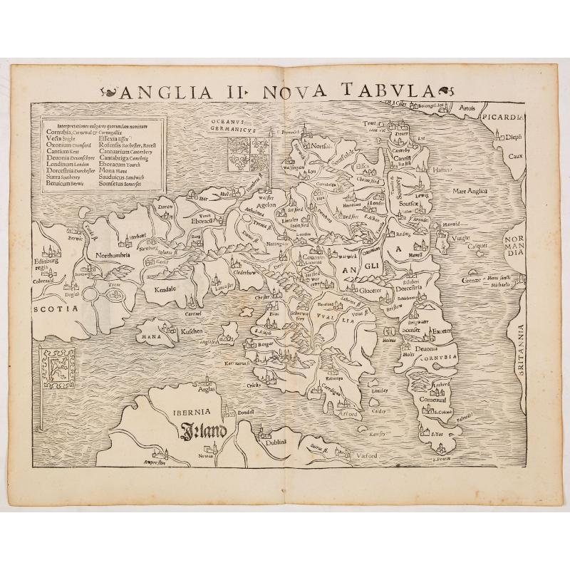
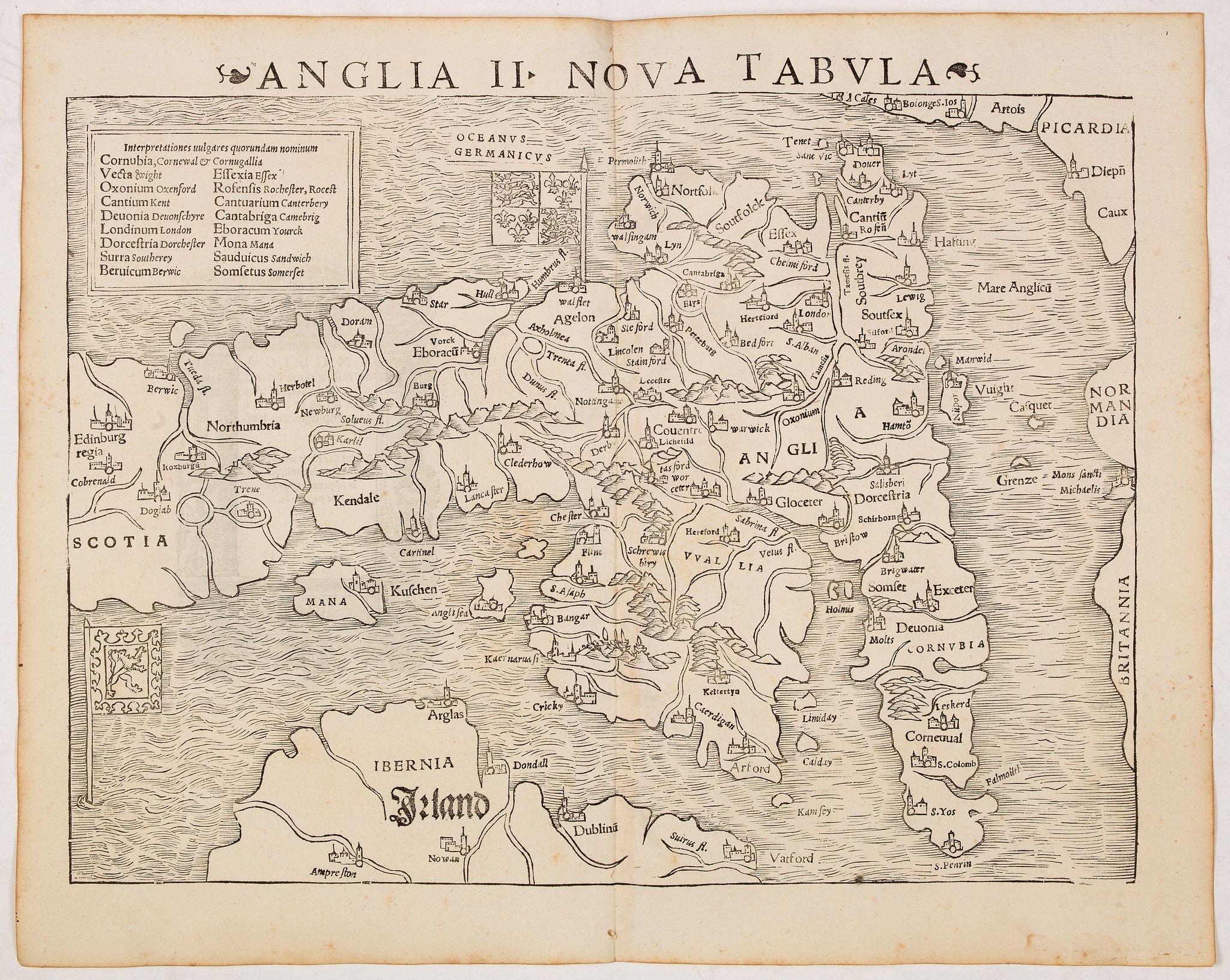
Anglia II Nova Tabula (British Isles) |
||||||||||||||||||||
|
||||||||||||||||||||
|
|
||||||||||||||||||||
|
Selling price: $475
Sold in 2014 |
Views: 208
|
|||||||||||||||||||
Description
The first edition of Munster's first printed separate map of England and Wales, with Scotland as far north as Edinburgh, the east coast of Ireland and north coast of France. North oriented to the left. Appeared in his "Geographia Universalis", first published in 1540.
The Geographia was a new and important edition of Ptolemy, with redesigned maps and the text revised by Münster based on the Willibald Pirckheimer Latin translation with corrections of 1535 by Servetus
On verso a decorative woodcut border who were probably cut by the famous 16th century woodcutter Hans Holbein.
The Geographia was landmark work which contained, along with the Ptolemaic maps, several of the most significant modern maps in the history of cartography.
Sebastian Münster (1448-1552) was a mathematician, geographer and professor at Basel University. He also compiled a highly influential encyclopedic work entitled Cosmographia universalis, which first appeared in 1544 and contained forty-eight woodcut maps. He was among the first editors of a published geographical text to quote or acknowledge his sources and authorities.
Now-a-days difficult to find in original untouched condition, as most examples on the market have modern color added.
Reference: Shirley, British Isles 1477-1650, 28.