Lot #: 16793
Listing ID: #2427 has been added to your wishlist.
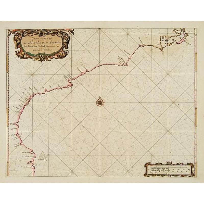
Carte vande Cust van Florida tot de Verginis streckende van Cabo de Carnaveral tot Baya de la Madalena. |
||||||||||||||||||||
|
||||||||||||||||||||
|
|
||||||||||||||||||||
|
Selling price: $8025
Sold |
Views: 212
|
|||||||||||||||||||
Description
An extremely rare and attractive chart of the coast of Florida extending from Cape Canaveral in Florida and following the coasts from South and North Carolina up to Cape Hatteras in North Carolina.
No signature of Roggeveen and plate number 25.
From arguably the rarest 17th-century Dutch sea atlas. Roggeveen's charts are prized for their distinctively robust engraving style as well as for their cartographic singularity. Roggeveen drew upon Willem Blaeu's West Indische Paskaert , and after the Van Loon chart of 1661.
The map was published in Roggeveen's Het Eerste Deel Van Het Brandende Veen and subsequently used by Goos in his 1676 Spanish edition of De Zee-Atlas.
Arent Roggeveen was the first chartmaker who succeeded in the publication of a printed set of charts for the navigation in the Atlantic, the West Indies and West Africa.
with signature of Roggeveen.
Collector's item ! °
Reference: Koeman, Atlantes Neerlandici, VI, Rog 1.