Lot #: 37886
Listing ID: #27909 has been added to your wishlist.
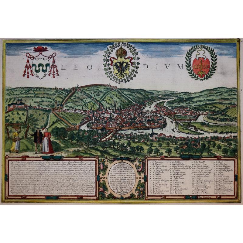
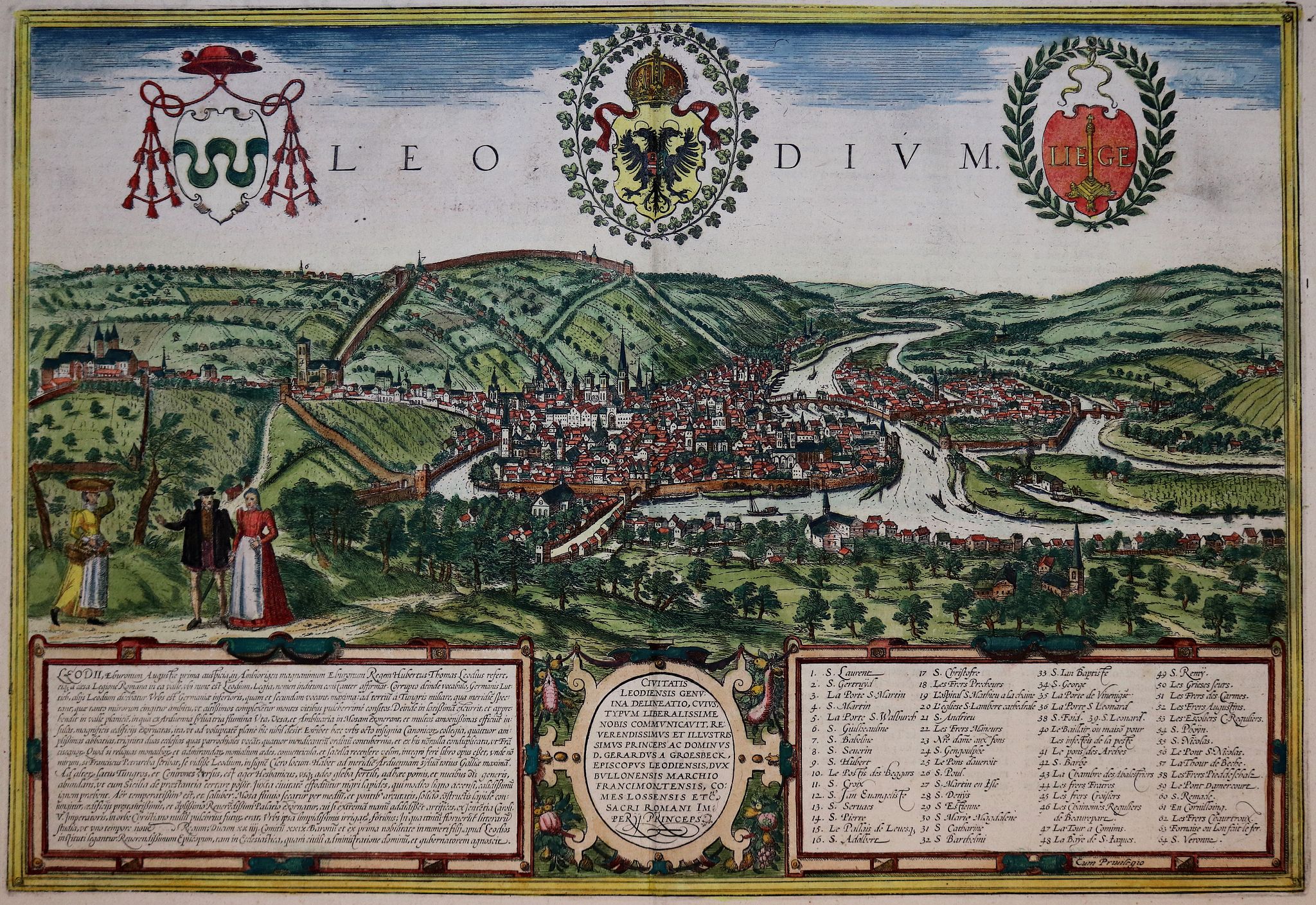
Leodium. (Luik or Liège) |
||||||||||||||||||||
|
||||||||||||||||||||
|
|
||||||||||||||||||||
|
Selling price: $350
Sold in 2019 |
Views: 176
|
|||||||||||||||||||
Description
Very desirable and early of Liège, which shows the city with the Meuse flowing in its favorable location amongst gentle hills, sturdy trees and fertile fields.
With a numbered key (1-64). Presented in spatial depth and exuding a striking sense of animation, it is one of the most successful landscapes in Braun and Hogenberg's city atlas.
In 1468 Liège was attacked by Charles the Bold and set alight, profoundly altering the medieval face of the city. From the second half of the 15th century onwards much of the city was rebuilt in the contemporary style. The illustration shows the Ourthe flowing into the Meuse and the concentration of buildings in the city center with its soaring churches and hospices. The cathedral of Saint-Lambert (20), which would later be destroyed in the upheaval of the French Revolution, is impressively documented. The Gothic collegiate church of Saint-Paul (26, center right) was made Liège's new cathedral. Examples of Romanesque architecture include the collegiate churches of Saint-Denis (right, 28), Saint-Barthélemy (32) and the church of Saint-Martin (far left), which was built in the Gothic style in the early 16th century." (Taschen, Braun and Hogenberg, p.64.)
From volume one of the greatest publication in this genre!. The Civitates was compiled and written by George Braun, Canon of Cologne Cathedral. Braun gathered together vast amounts of information and draft plans to produce over 500 city views/maps published in six parts between 1572 and 1617. Most of these engravings were made by Simon Novellanus and Frans Hogenberg, many after drawings by Joris Hoefnagel.
Read more about the Civitates Orbis.
Reference: Koeman (1967-70) B & H 1-5, NMM III, i, 459 (1573-1618 ed.), Introduction', in: G. Braun and F. Hogenberg, Civitates orbis terrarum (Amsterdam: 1965). (2)