Lot #: 81652
Listing ID: #33518 has been removed from your wishlist.
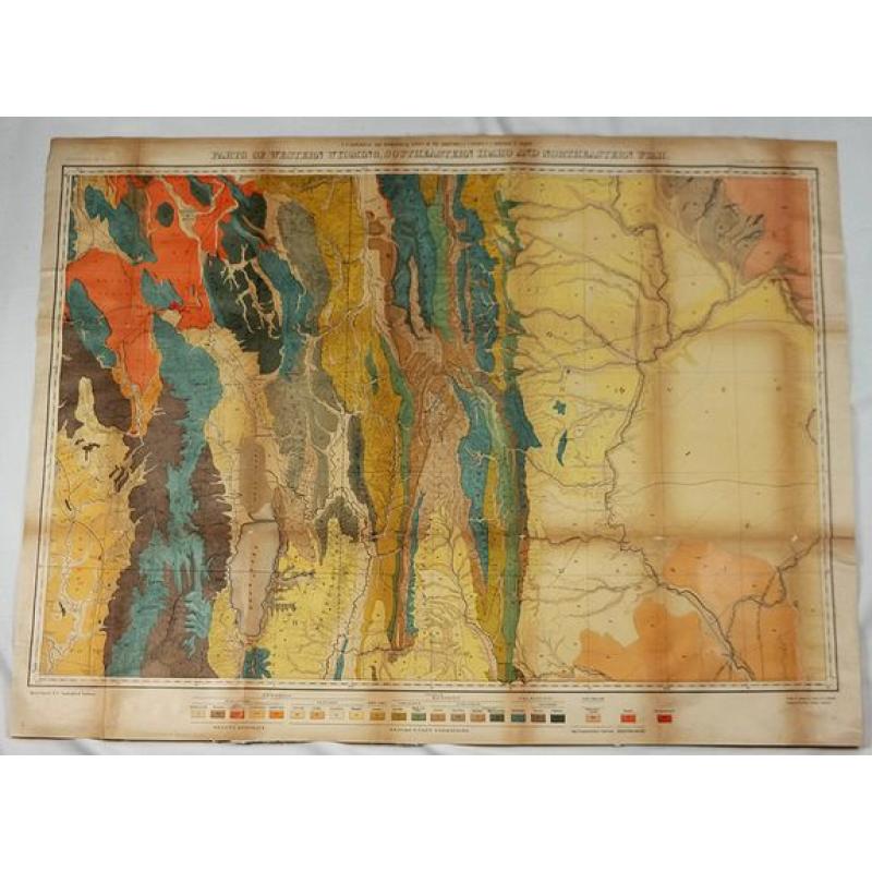
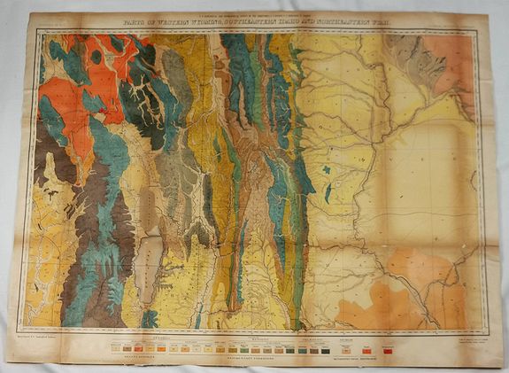
Parts of Western Wyoming, Southeastern Idaho and Northeastern Utah. |
||||||||||||||||||||
|
||||||||||||||||||||
|
|
||||||||||||||||||||
|
Selling price: $13
Sold in 2018 |
Views: 145
|
|||||||||||||||||||
Description
A fine, detailed economic map of portions of the mid-western states of Wyoming, Idaho and Utah, published in 1883 in Hayden's 12th Annual Report.
It is a spectacular, early chromolithograph map of Yellowstone printed in 18 colors by the notable firm of Julius Bien.
In 1867, Congress established the Geological and Geographical Survey of the Territories. Originally just focused on Nebraska, it soon expanded to cover all the territories around the Rocky Mountains.
Dr. Ferdinand Vandeveer Hayden was appointed geologist in charge and he led the surveys and issued reports between 1867 and 1883, including information on the geography, geology, ethnology and many other scientific subjects. His surveys were a landmark in the history of the exploration and documentation of the American West.
Ferdinand Vandeveer Hayden (1829–1887) was an American geologist noted for his pioneering surveying expeditions of the Rocky Mountains in the late 19th century.