Lot #: 21181
Listing ID: #3731 has been added to your wishlist.
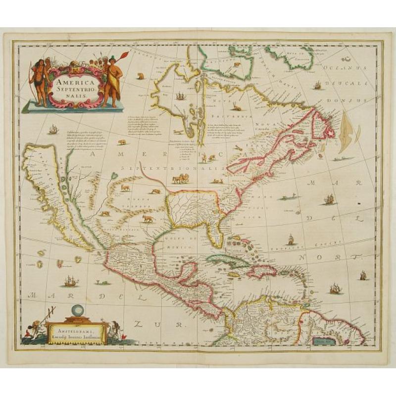
America Septentrionalis. |
||||||||||||||||||||
|
||||||||||||||||||||
|
|
||||||||||||||||||||
|
Selling price: $4600
Sold |
Views: 126
|
|||||||||||||||||||
Description
Showing California as an island, and above, the north west of the continent left blank except for two legends explaining the discoveries to that date. The Hudson Bay is called Buttons Bay, and the St Lawrence flows from Lake Iroquois, the only Great Lake to be shown.
This important map was the first issued in a Dutch atlas to concentrate solely on North America and show California as an Island. In Nova Anglia three lakes are depicted.
Other cartographers of that time followed the older map by Champlain, making this map an important precursor for the mapping of the region. Latin text on the reverse.
Reference: Tooley, The mapping of America,p.311/ Goss, The mapping of North America,p.72 / Karpinski, Maps of famous cartographers depicting North America, p.89.