Lot #: 23929
Listing ID: #8061 has been added to your wishlist.
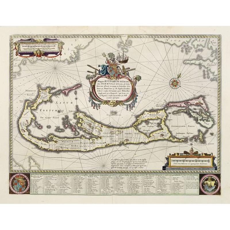
Mappa Aestivarum Insularum alias Barmudas. |
||||||||||||||||||||
|
||||||||||||||||||||
|
|
||||||||||||||||||||
|
Selling price: $2600
Sold in 2008 |
Views: 192
|
|||||||||||||||||||
Description
Blaeu based his work on John Speed's remarkably accurate map of 1626-1627. It shows the island divided into tribes and lots, and below the map itself appear the names of the first proprietors and the number of shares assigned each.
A splendid cartouche shows Neptune astride the Royal Arms holding a ship. The miniature map below the cartouche shows the correct proportion of the island to the coast of the mainland.
Further adorned with scale cartouches, coats of arms and compass rose with a fleur-de-lys. The map is superimposed over a map of the Atlantic with the coastlines of Britain, North America and Hispaniola showing the location of Bermuda.