Lot #: 23950
Listing ID: #8081 has been removed from your wishlist.

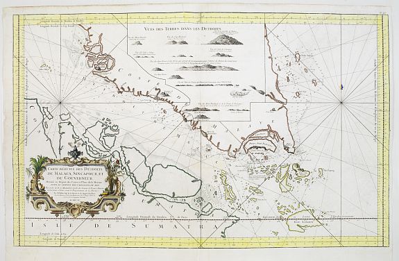
Carte Réduite des Detroits de Malaca, Sincapour, et du gouverneur |
||||||||||||||||||||
|
||||||||||||||||||||
|
|
||||||||||||||||||||
|
Selling price: $950
Sold |
Views: 174
|
|||||||||||||||||||
Description
Attractive large chart showing Malay Peninsula from north of Selangor to Pulor Tioman with adjacent coast of Sumatra and the islands southwards to Lingga. Latitude and longitude scales, soundings. Recommended tracks through the straits. Inset with number of small coast views.
The outline for Singapore is severely distorted, an unusual pair of islands being shown in the old Straits to the north of present-day Singapore Island. Coastal profiles fill the upper centre of the chart.
An important, detailed and decorative chart, one of the few 18th century charts to focus in detail on Singapore and its environs.
Reference: M.C.C.S., 109, Nr.54.